Practical image geolocation guides.
Learn how to read visible clues, work without GPS metadata, geolocate screenshots and video frames, compare reverse image search results and verify photo location hypotheses with evidence.
How to Find Where a Photo Was Taken
Nine practical methods for checking EXIF, reading signs, using OCR, comparing landmarks, trying reverse search and verifying candidates with maps.
Geolocate Images Without GPS Data
How to work with screenshots and shared photos after EXIF location metadata has been stripped by apps or platforms.
OSINT Image Geolocation Workflow
A structured process from source preservation and visual clue inventory to verified location candidates.
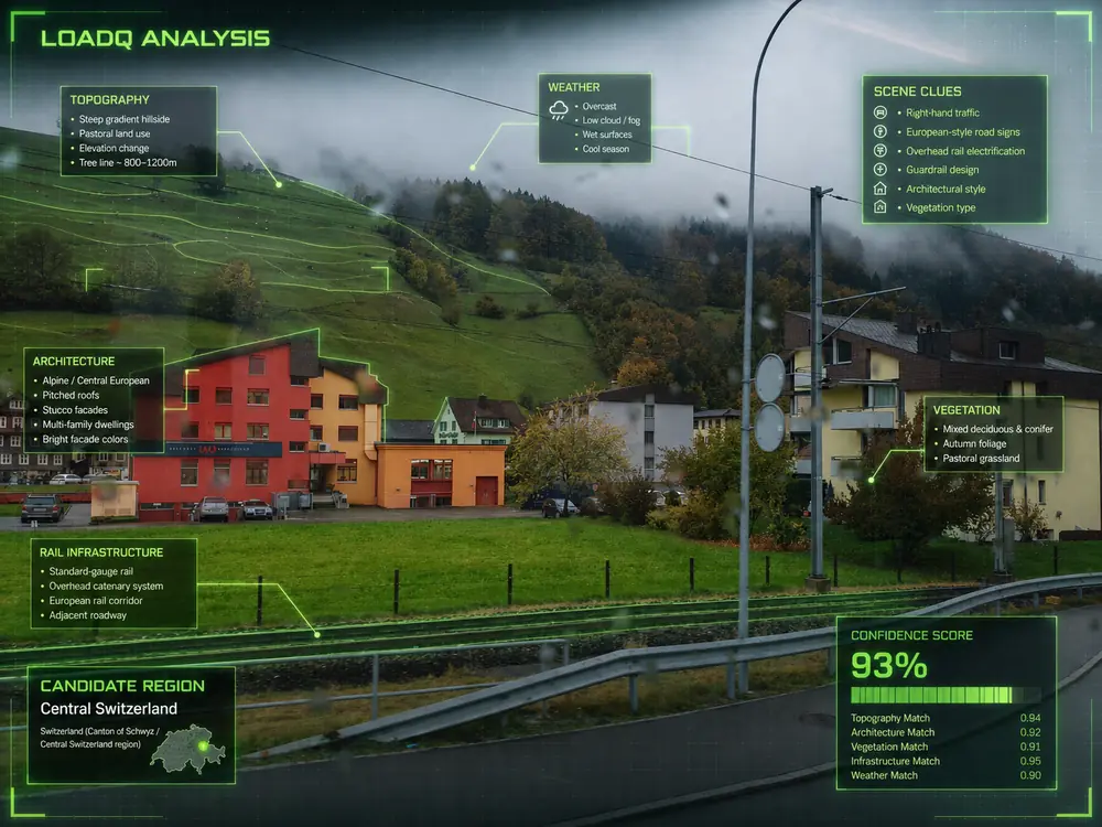
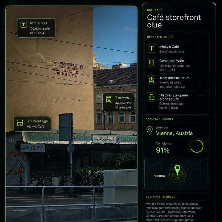
Visual Clues for Image Geolocation
Signs, roads, architecture, vehicles, terrain and vegetation as practical location evidence.
Why Reverse Image Search Is Not Enough
How to move beyond similar-image matches into location-specific evidence and map verification.
AI Photo Geolocation Accuracy and Limits
What affects confidence, when AI location estimates are useful, and when the evidence is too weak.
Find Location From Screenshot
A practical workflow for OCR, overlays, source context, reverse search crops and map verification.
EXIF GPS Location Finder
How to read coordinates, spot stripped metadata, handle spoofed tags and verify the visible scene.

Google Lens vs AI Photo Geolocation
When Lens works, when reverse search fails, and how AI-assisted location reasoning fills the gap.
How to Geolocate a Video Frame
Choose strong frames, extract OCR, use motion context and verify stable map geometry.
How to Geolocate Instagram Photos
Use captions, location tags, Story overlays, repost checks and visual evidence responsibly.
Photo Geolocation Checklist
A repeatable checklist for metadata, OCR, visual clues, reverse search and map verification.
Built around the LoadQ geolocation cluster.
Each guide links to a focused workflow page so readers can move from learning into an actual scan, while Google sees a clear topic structure around image geolocation.